
Natma Taung ASEAN Heritage Park
Maung Yin Kyay

Natma Taung ASEAN Heritage Park
Maung Yin Kyay
Natma
Taung known locally as Khaw Nu M’ Cong and in the past as Mt. Victoria is
situated in southern Chin State Mindat, Matupi and Kanpetlet townships covering
an area of 275.35 sq. miles (176,202 acres) at an altitude of more than 10,200
ft. above sea level. The area covered with mountain mists contains Buran
(Rhodondendron arboretum) tree that produces the state flower of Chin State,
Cherry and pine trees.
Natma
Taung had more than 800 tree species and is an area where degradation of
natural environment was kept at a minimum level. Surveys found 23 amphibians,
65 reptiles and 77 butterfly species as well as rare cats, bear, mountain
goats, pangolins, monkeys and the region’s own White-browed Nuthatch as well as
289 different species of birds.
Natma
Taung had become a national park in 2010 and numbers of visitors reached the
peak number during the New Year transiting from 2018 to 2019.
This
Christmas and the New Year was the time when most visitors came to our
Kanpetlet town. Visitors came under the arrangement of travel companies as well
as on their own. People from nearby areas of Magway, Minbu and Pakokku also
came by motorcycles. About 1,500 visitors came every day. The majority stay in
Kanpetlet at an elevation of more than 4,500 ft. and then climb the Natma Taung.
So the six hotels in Kanpetlet hotel zone as well as motels and inns were
always full of visitors. Some stay in their friends or relatives houses too
said a Kanpetlet local Chin ethnic national Ko Ki Nine.
Even
before 4 a.m. in the chilling misty morning, Kanpetlet came to life with the
sounds of cars and motorcycles warming up to start the journey up Natma Taung.
Cars were permitted up to the 10 mile station at an altitude of 9,000 ft. above
sea level and from there on the area became a restricted national park area
where no cars except for specially permitted one were allowed. Visitors can proceed
to the top of the mountain by foot or by motorcycles.
Most
of the visitors hike up the mountain while enjoying the natural beauty and the
sounds of the birds. Some women and children who prefer an easier way up and
down took a motorcycle ride offered by the locals at Ks 5,000 for ascent and Ks
5,000 for descent. This bike ride had its fair share of accidents resulting in
scratches, cuts and bruises but still those who want to take the motorcycle
ride were always more than the available motorcycles so there was a
considerable waiting time. Locals from Kanpetlet area were also gaining a
sizable income from this.
The
path to the top of the mountain from 10 mile station was about 3 miles 4
furlong long and there were no shops or stalls along the way so it is important
for visitors to bring along sufficient food and water. The hike up the mountain
took about three to five hours and those who attempt it need to have enough
stamina to complete it.
However,
all along the way was irresistible photo ops and for most who attempted the way
up would find the hike well worth it.
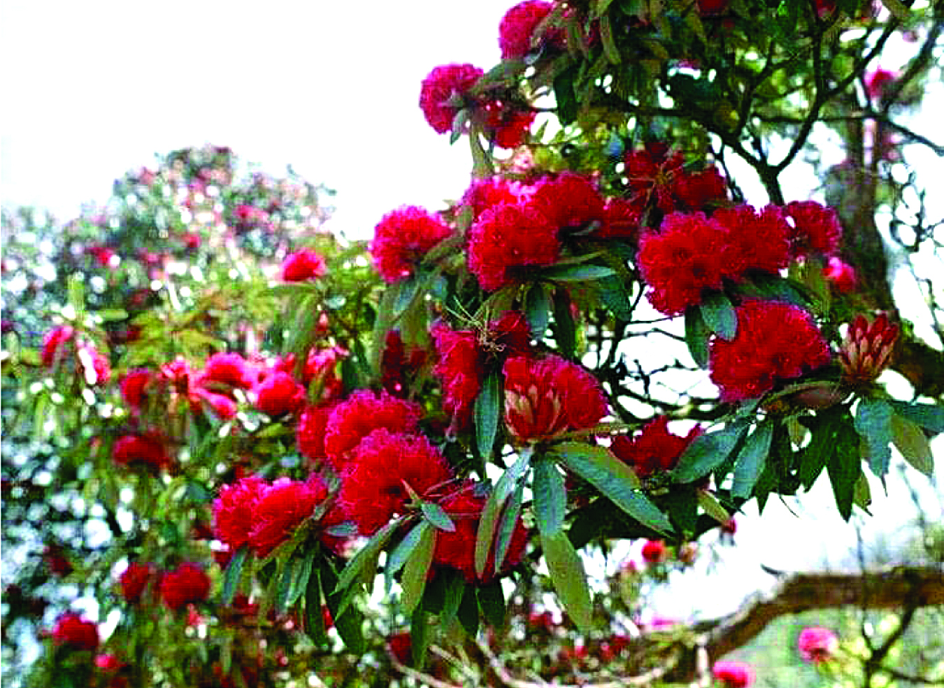
Rhodondendron
flower, the Chin State national flower is normally red in colour and can be
found all along the mountain path but beyond an elevation of 10,000 ft. rare
white and yellow colour flowers can also be found. Locals were said to have
produce wines from their national flower.
To
preserve the state flower from extinction, Forest Department had strictly prohibited
peoples from picking the flowers or even breaking off the branch of the tree.
This was a timely conservatory move. Forest Department had also started a
campaign on reducing usage of plastics and had setup trash bins along the way.
However, it was a sorrowful sight to see discarded plastic bags and water
bottles littering many locations along the path. It looks like more still need
to be done.
Just
past the 9,000 ft. elevation is a small ice covered pond measuring 20 ft. by 15
ft. attracting visitors taking pictures and inspecting it.
It
was a unique experience to walk the natural path surrounded by small bamboo
clusters and shrubs and all the tiredness was taken away by the splendid sight
awaiting the climbers at the mountain top.
Natma
Taung region situated at an elevation above 10,000 ft. is not a proud natural
heritage for Myanmar only but also for ASEAN region as well. Visitors coming by
car to the area from all over Myanmar must pass through Kazunma town at the
junction of Pathein-Monywa road in Magway Region Seikpyu Township to Saw town
where all will stop briefly before ascending up the road to Kanpetlet town at
an elevation of 4,500 ft. through breath taking sights.
At
Kanpetlet, they’ll be entertained by old Chin women with tattoos on their cheek
who’ll play the pipe with their noses! They can also buy Chin clothes weaved in
traditional looms as souvenir. In the evening they can enjoy traditional Chin
moon shine liquor and Gayal meat pounded together with chillies beside a born
fire. Gayals from Chin mountain ranges belong to the same species (Gavarus) of
bison and banteng. These beasts were usually bred for meat and could also be
found living in the wild between 2,000 and 10,000 feet above sea level.
All
are invited to come and enjoy these as well as the natural beauty of Natma
Taung. – translated by Handytips
No comments:
Post a Comment